Vision
Reimagine Middle Branch is a community-driven initiative to reconnect South Baltimore to its shoreline
Reimagine Middle Branch is a community-driven initiative to reconnect South Baltimore to its shoreline
Reimagine Middle Branch extends from Curtis Bay and Brooklyn in the south to Cherry Hill, Lakeland, Westport, Mt. Winans, and St. Paul west of the water; north to Carroll-Camden, Pigtown, Barre Circle, Ridgely’s Delight, and the Entertainment District; and east to Sharp-Leadenhall, Otterbein, Federal Hill, Riverside, Locust Point, South Baltimore, and the Baltimore Peninsula (formerly Port Covington).
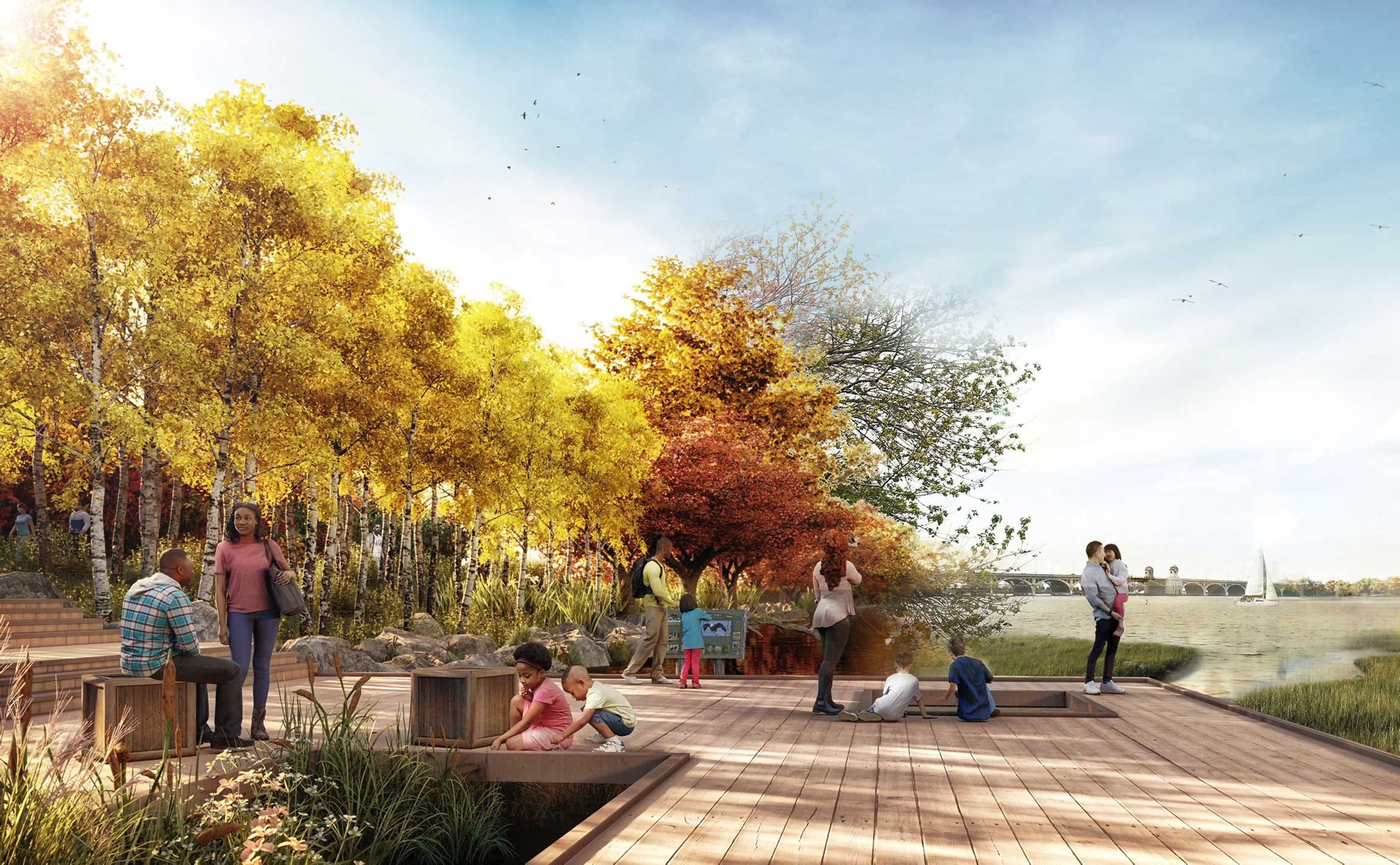
Historically, the Middle Branch had a gradual, natural, and resilient shoreline edge typical of the Chesapeake Bay. Over time this edge was reshaped and hardened by industry and infrastructure, resulting in a shoreline that today is thin, fragmented, and impacted by trash, highways, vacancy, and erosion.
Likewise, the neighborhoods of South Baltimore that surround the Middle Branch are disconnected from one another and the water due to historic disinvestment, transportation infrastructure, and industrial uses. These neighborhoods are diverse and vibrant communities, despite this physical isolation.

The Middle Branch flows through some of the traditional and unceded lands of Piscataway and Susquehannock peoples.
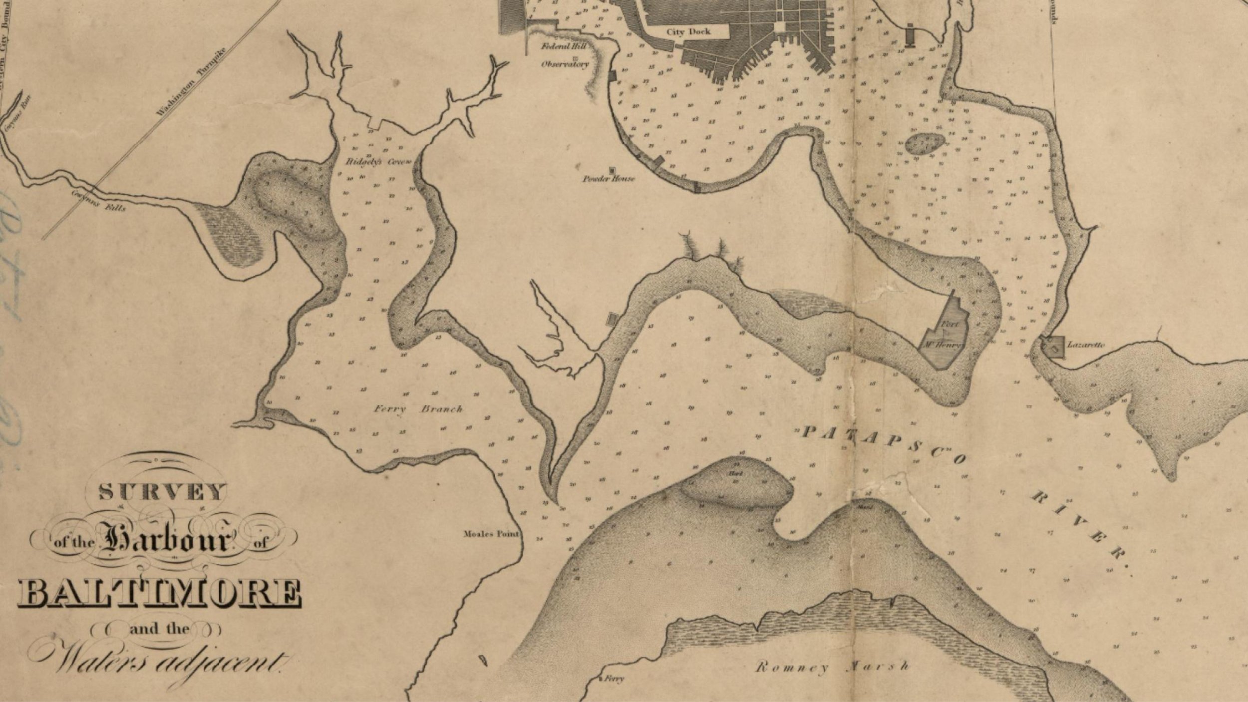
One of the earliest maps of the Middle Branch shows a thick, natural, and resilient shoreline edge that evoked the soft and green expanse of the Chesapeake Bay.
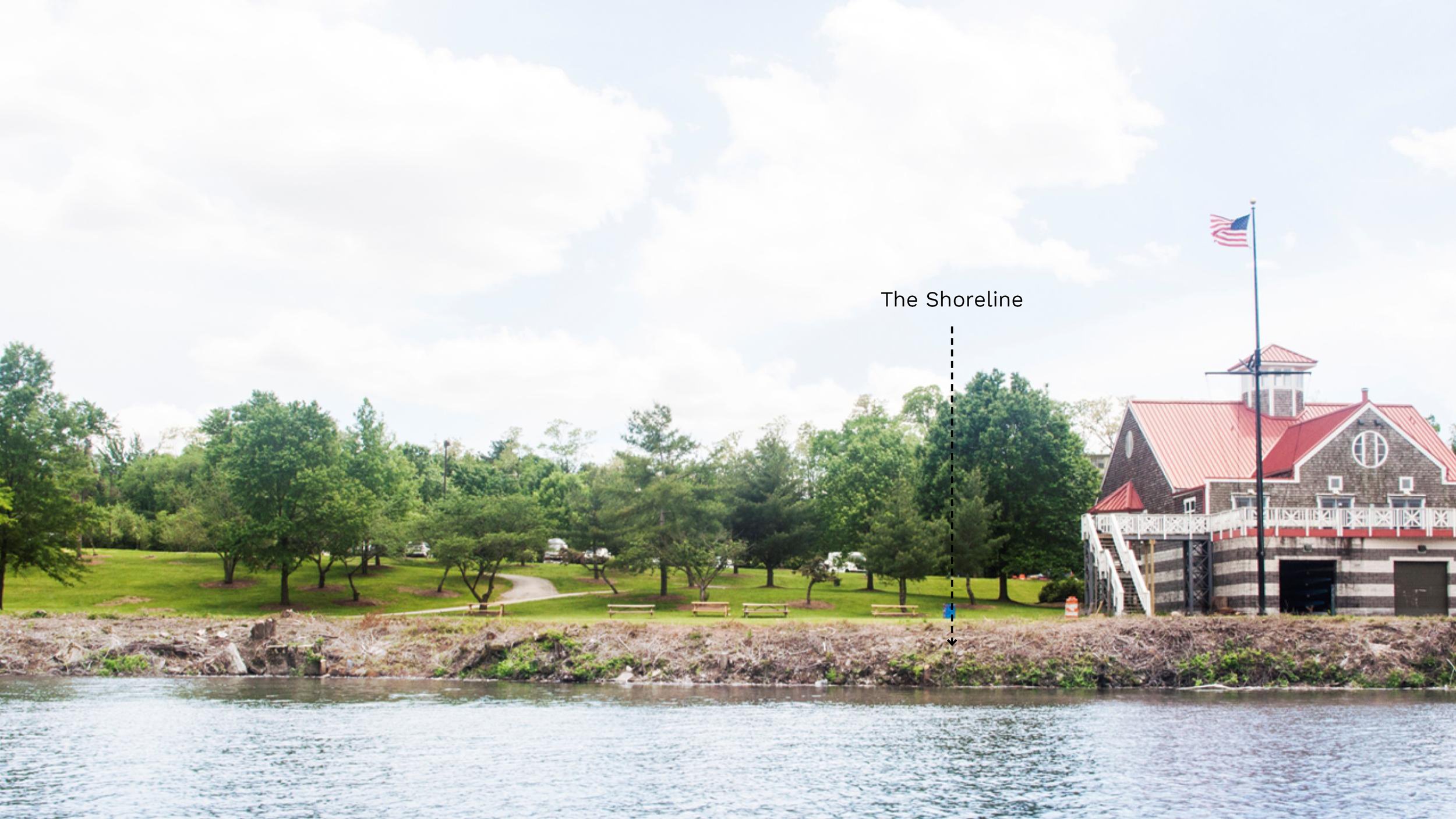
Through time this edge has been reshaped and hardened by industry and infrastructure, resulting in a shoreline today that is thin and fragmented.
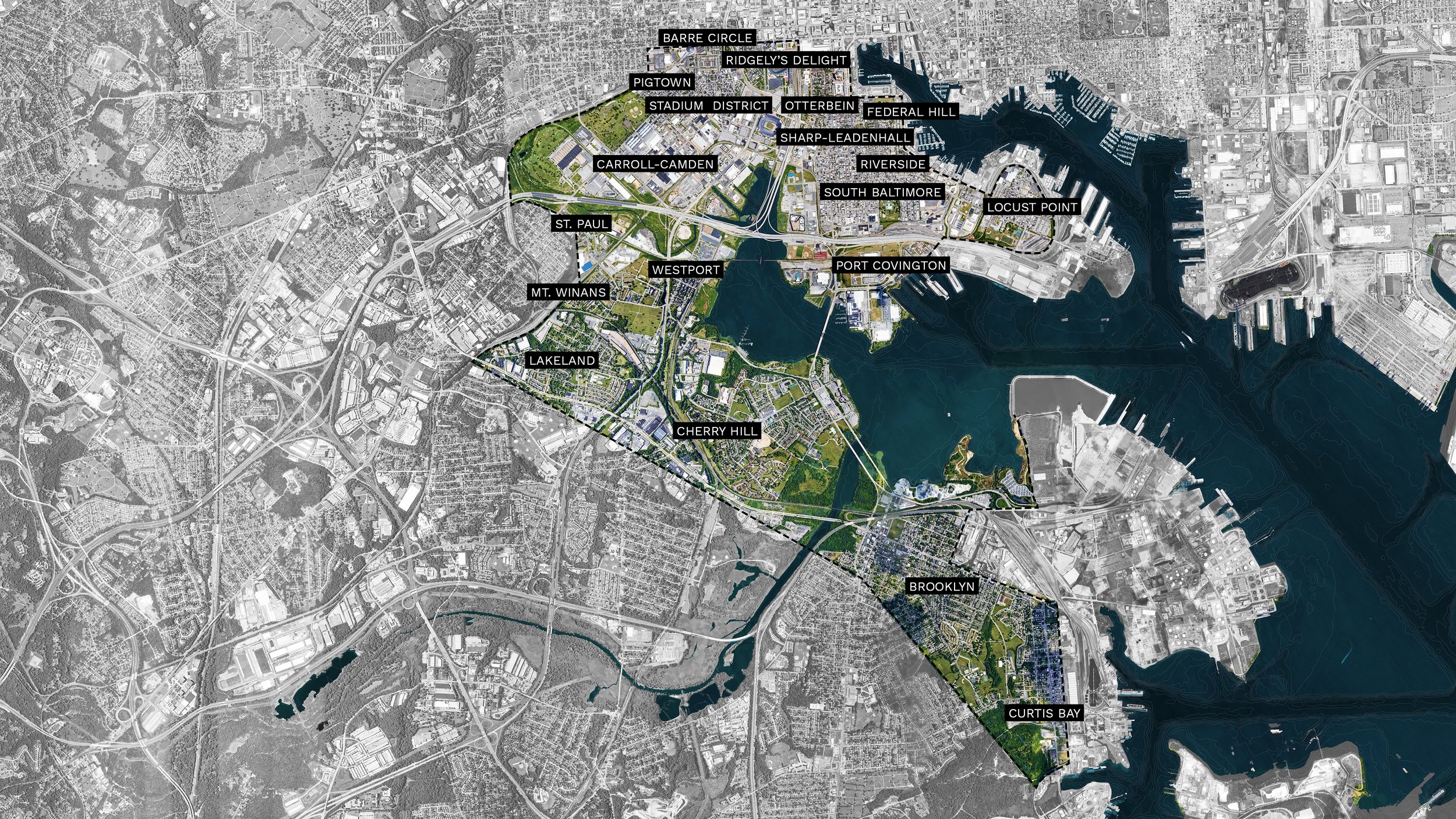
19 unique neighborhoods surround the Middle Branch. They include: Curtis Bay, Brooklyn, Cherry Hill, Lakeland, Westport, Mt. Winans, St. Paul, Carroll-Camden, Pigtown, Barre Circle, Ridgely’s Delight, the Stadium District, Sharp-Leadenhall, Otterbein, Federal Hill, Riverside, Locust Point, South Baltimore, and Baltimore Peninsula (formerly Port Covington).
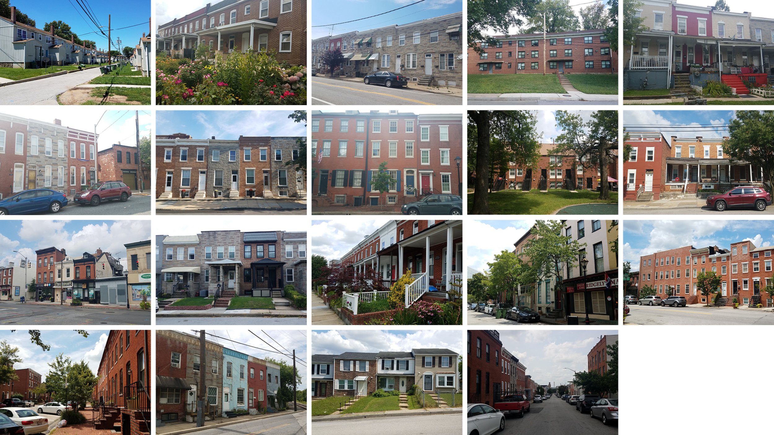
The Middle Branch neighborhoods are distinct in character, demographics, and land use. Ranging from residential enclaves to industrial centers, an entertainment district and the city’s largest new development zone, South Baltimore has an incredibly diverse and varied urban fabric.
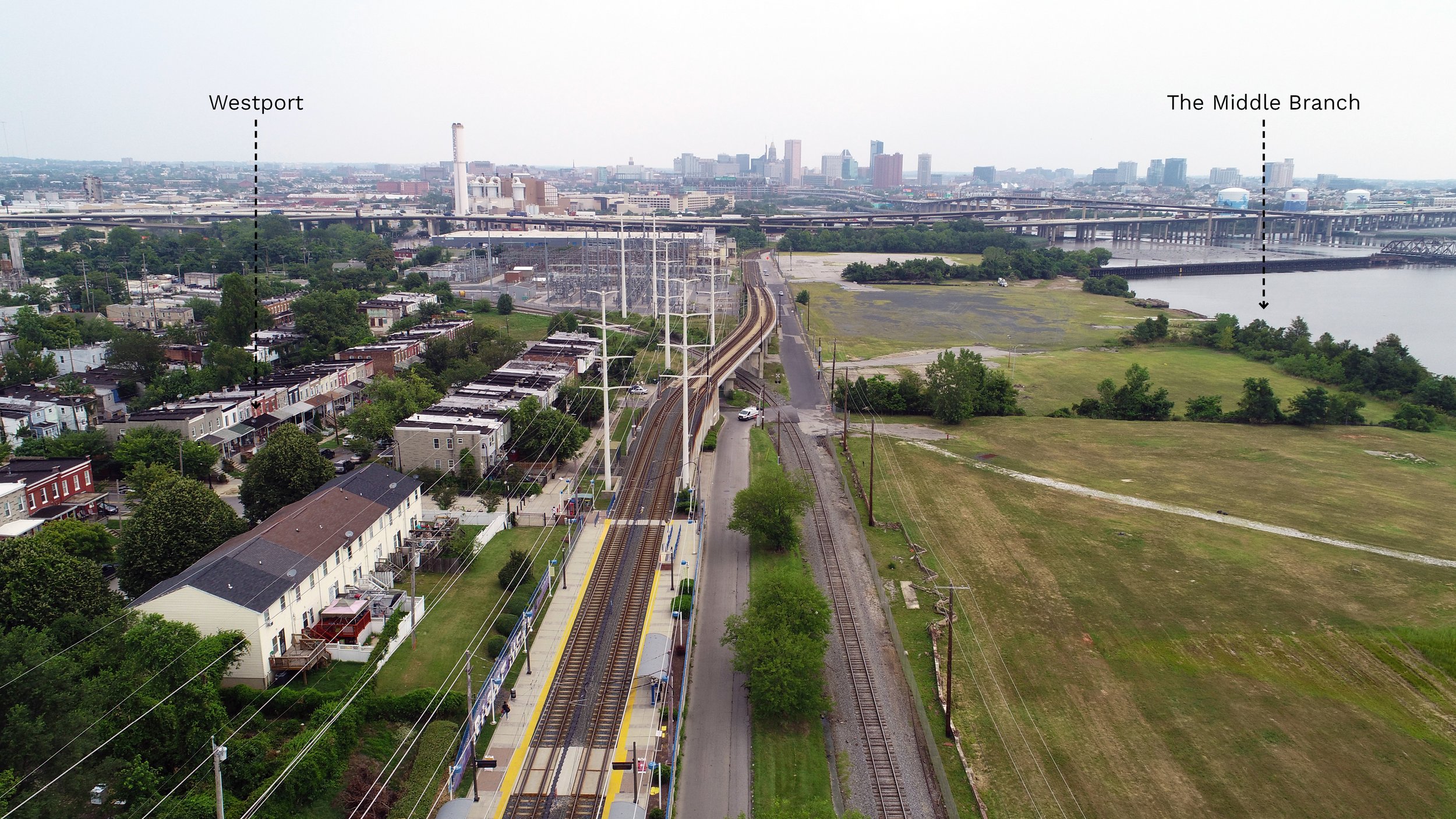
Roads, railways, and highways dominate South Baltimore and create barriers in communities. The barriers separate the neighborhoods from one another and from the water, creating ‘urban islands’ around the Middle Branch.
Reimagine Middle Branch aims to build a network of places and spaces that support health, vitality, and future investments across the Middle Branch “park-shed” and its adjacent communities.
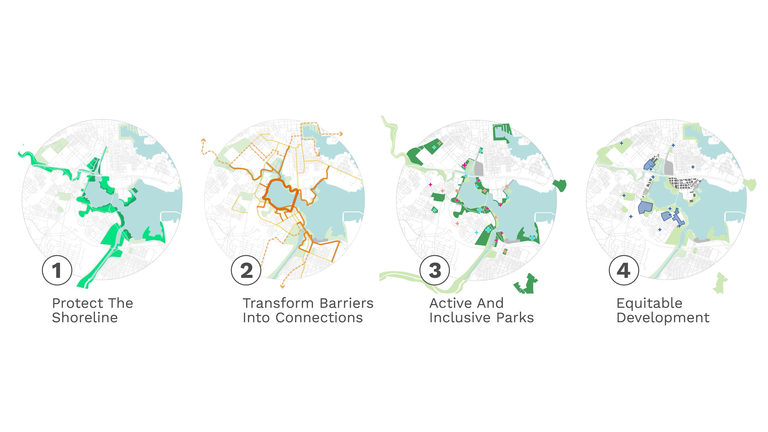
The transformation of the Middle Branch is organized into four equity-driven frameworks: 1) Protect the Shoreline; 2) Transform Barrriers into Connections; 3) Active and Inclusive Parks; and 4) Equitable Development.
The frameworks comprise physical and place-based transformations that reflect the Plan’s goals. Wide-reaching in scale and comprehensive in scope, these frameworks address the challenges confronting South Baltimore today, build on the momentum created by work currently underway in the area, leverage strategic opportunities with like-minded partners, and incorporate innovative design-based approaches to problem-solving and place-making.

The Middle Branch is part of the Chesapeake Bay, which is known for its beauty and bounty. Reimagine Middle Branch offers an incredible opportunity to protect and connect 11 miles of shoreline. This will improve the Patapsco’s water quality, restore its environmental health, and secure South Baltimore’s resilience in the face of climate change and increasing natural disasters.
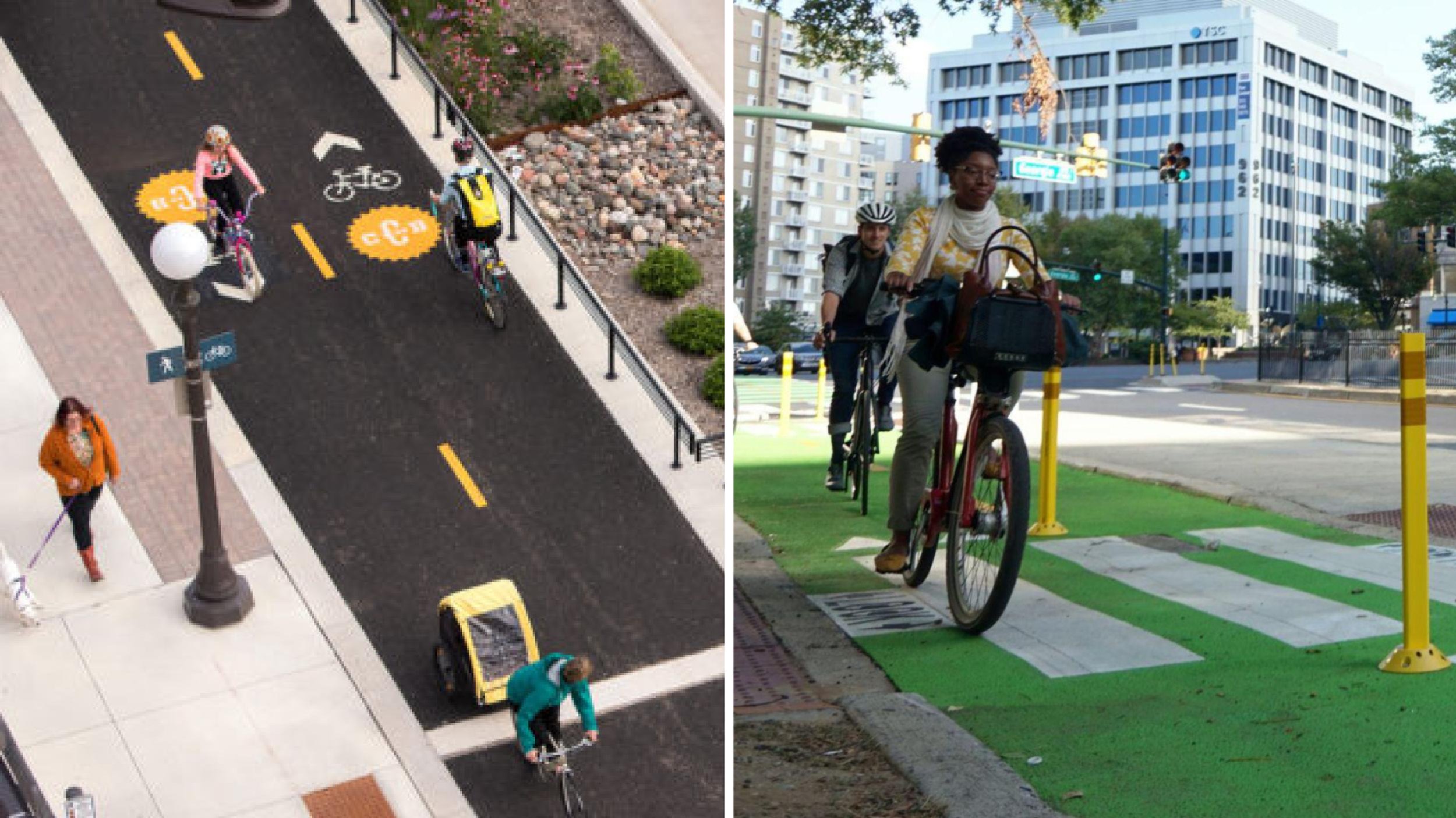
The area around the Middle Branch has been shaped by transportation infrastructure creating barriers and causing blight. Complete streets, which put existing roads on diets, will strengthen connections between neighborhoods and job centers. Combined with an extensive new trail network, pedestrians and cyclists will be able to make new safe connections between neighborhood and waterfront amenities.
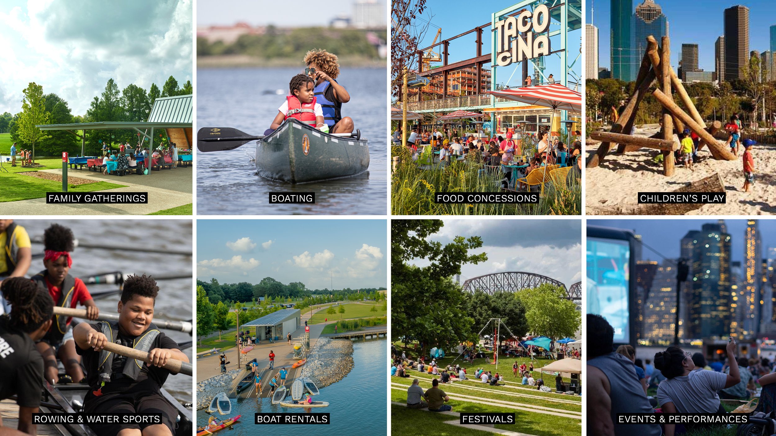
South Baltimore is home to nearly 600 acres of parks and open spaces, both on the water and in neighborhoods. Diverse in scale and character, these parks are a significant asset to the communities. Programming and facilities in parks today are beloved and well-used. In many cases, facilities are at or over capacity and can’t meet present demand of nearby communities. The Plan creates an active and inclusive park-shed for people by supporting current programming with expanded and enhanced facilities, and adding new features and amenities.

There is a wide range of needs and opportunities across the neighborhoods, and no one development strategy will be effective or appropriate across the entire park-shed. With this in mind, the Plan sets forth a bespoke and community-centered approach to development that leverages existing opportunities, supports burgeoning initiatives across South Baltimore, guides future development, and further details initiatives proposed in previous plans.